
Dencukaay:Aerial photo Port Stanley.jpg
Dayoob bii wonendi: 800 × 600 pixel. Yeneen ñawaay: 320 × 240 pixel • 640 × 480 pixel • 1 024 × 768 pixel • 1 280 × 960 pixel • 1 600 × 1 200 pixel.
réyal nataal bi ((1 600 × 1 200 pixels, réyaayu file bi : 220 kio, type MIME : image/jpeg))
| Lieu de la prise de vue | | Voir cet endroit et d’autres images sur : OpenStreetMap |
|---|
Faramfacce
This image was copied from wikipedia:en. The original description was:
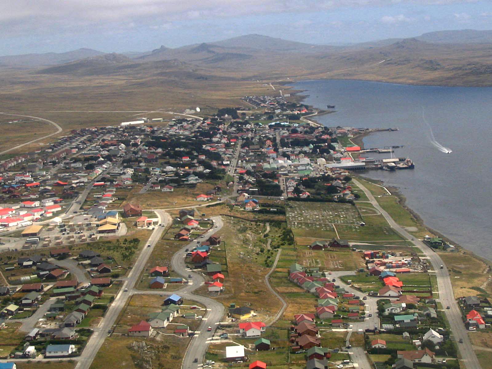
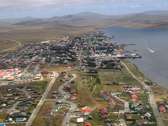
Port Stanley, from the air, 2005/02, by Tom L-C.
| date/time | username | edit summary |
|---|---|---|
| 22:16, 15 February 2005 | Tom L-C | (GFDL) |
| 22:13, 15 February 2005 | Tom L-C | (Port Stanley, from the air) |
Anami Jëfandikoo gi

|
Sañalees na duppi, séddale ak/walla soppi bile liggéey ci anami GNU Free Documentation License, Sumb 1.2 walla bépp sumb buFree Software Foundation mujjee siiwal; bu amul benn pàcc bees manul soppi, te amul it menn mbind ci xët wu njëkk week wu mujj wi. Ab sotti bu sañal gi jàppandi na ci pàcc bees duppee GNU Free Documentation License. |
| Jàppandeeb bii dencukaay a ngi aju ci sañal gu Creative Commons Féetale-Séddoo ci gennug anam 3.0 Unported | ||
. | ||
| Ce bandeau de licence a été ajouté à ce fichier dans le cadre de la procédure de mise à jour des licences des images sous GFDL. |
Jaar-jaaru dencukaay bi
Cuqal cib taariix/waxtu ngir gis ni dencukaay bi meloon ca jamono jooju.
| Taariix ak Waxtu | Tuutal | Dayoo | Jëfandikukat | Saraa | |
|---|---|---|---|---|---|
| teew | 2 Sattumbar 2013 à 20:26 | | 1 600 × 1 200 (220 kio) | Hohum | Levels |
| 11 Ut 2005 à 19:03 |  | 1 600 × 1 200 (193 kio) | Head | This image was copied from wikipedia:en. The original description was: Port Stanley, from the air, 2005/02, by Tom L-C. {{GFDL}} {| border="1" ! date/time || username || edit summary |---- | 22:16, 15 February 2005 || Tom L-C || <nowik |
Xët yi am wii ŋara
Xët wii ci suuf ëmb na wii ŋara
Fépp fees jëfandikoo dencukaay bi
Yeneen wiki yiy toftal dañuy jëfandikoo itam bii dencukaay:
- Jëfandikoo nañu ko ci af.wikipedia.org
- Jëfandikoo nañu ko ci ar.wikipedia.org
- Jëfandikoo nañu ko ci arz.wikipedia.org
- Jëfandikoo nañu ko ci ast.wikipedia.org
- Jëfandikoo nañu ko ci azb.wikipedia.org
- Jëfandikoo nañu ko ci az.wikipedia.org
- Jëfandikoo nañu ko ci bat-smg.wikipedia.org
- Jëfandikoo nañu ko ci be-tarask.wikipedia.org
- Jëfandikoo nañu ko ci be.wikipedia.org
- Jëfandikoo nañu ko ci bg.wikipedia.org
- Jëfandikoo nañu ko ci bn.wikipedia.org
- Jëfandikoo nañu ko ci br.wikipedia.org
- Jëfandikoo nañu ko ci bs.wikipedia.org
- Jëfandikoo nañu ko ci ca.wikipedia.org
- Jëfandikoo nañu ko ci ceb.wikipedia.org
- Jëfandikoo nañu ko ci cs.wikipedia.org
- Jëfandikoo nañu ko ci da.wikipedia.org
- Jëfandikoo nañu ko ci de.wikipedia.org
- Jëfandikoo nañu ko ci de.wikivoyage.org
- Jëfandikoo nañu ko ci el.wikipedia.org
- Jëfandikoo nañu ko ci en.wikipedia.org
- Jëfandikoo nañu ko ci en.wikivoyage.org
- Jëfandikoo nañu ko ci eo.wikipedia.org
- Jëfandikoo nañu ko ci es.wikipedia.org
- Provincia de Tierra del Fuego, Antártida e Islas del Atlántico Sur
- Malvinenses
- Puerto Argentino/Stanley
- Anexo:Monumentos de la Provincia de Tierra del Fuego, Antártida e Islas del Atlántico Sur
- Wikiproyecto:Patrimonio histórico/Fotos de monumentos de Argentina sin id
- Apostadero Naval Malvinas
- Anexo:Localidades de las islas Malvinas
Wone njëfandikoo gu daj gu bii dencukaay.