
Dencukaay:Whole world - land and oceans 12000.jpg

Dayoob bii wonendi: 800 × 400 pixel. Yeneen ñawaay: 320 × 160 pixel • 640 × 320 pixel • 1 024 × 512 pixel • 1 280 × 640 pixel • 2 560 × 1 280 pixel • 24 000 × 12 000 pixel.
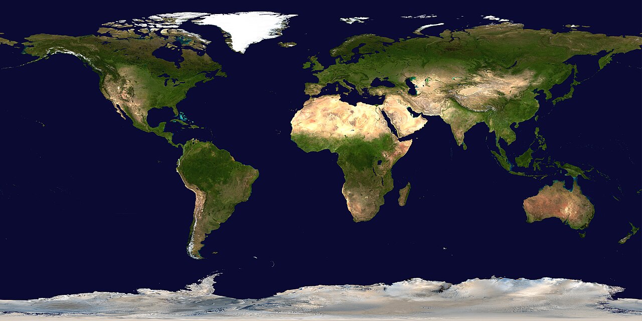
réyal nataal bi ((24 000 × 12 000 pixels, réyaayu file bi : 19,11 Mio, type MIME : image/jpeg))
Faramfacce
| Avertissement | Certains navigateurs peuvent avoir des difficultés à afficher cette image à sa résolution complète : elle possède un nombre de pixels singulièrement élevé et peut ne pas se charger correctement ou faire planter votre navigateur. |
|---|
| Faramfacce |
Deutsch: Satellitenbild der Erdoberoberfläche.
English: Satellite composition of the whole Earth's surface.
العربية: صور ساتليَّة مُجمَّعة لتُظهر سطح الأرض كاملًا. |
| Taariix | image released 11. Feb. 2002 |
| Gongikuwaay |
NASA - Visible Earth, images combined and scaled down by HighInBC (20 megabyte upload limit) |
| Aji-jëf | NASA/Goddard Space Flight Center |
| Sañal (Njëfandikoowaatu bii dencukaay) |
Copyright information from http://visibleearth.nasa.gov/useterms.php - With the exception of images produced by the SeaWiFS, QuickBird, and IKONOS instruments all images on the Visible Earth are governed by NASA's Terms of Use below. [...] For all non-private uses, NASA's Terms Of Use are as follows: 1. The imagery is free of licensing fees 2. NASA requires that they be provided a credit as the owners of the imagery [...] |
| Autres versions |
|


|

Anami Jëfandikoo gi
| Ce fichier provient de la NASA. Sauf exception, les documents créés par la NASA ne sont pas soumis à copyright. Pour plus d'informations, voir la politique de copyright de la NASA. | ||
 |
Attention :
|
Jaar-jaaru dencukaay bi
Cuqal cib taariix/waxtu ngir gis ni dencukaay bi meloon ca jamono jooju.
| Taariix ak Waxtu | Tuutal | Dayoo | Jëfandikukat | Saraa | |
|---|---|---|---|---|---|
| teew | 14 Ut 2006 à 19:58 | | 24 000 × 12 000 (19,11 Mio) | HInBC | {{Information| |Description = Satellite composition of the whole Earth's surface. |Source = NASA - Visible Earth, images combined and scaled down by HighInBC (20 megabyte upload limit) * [http://visibleearth.nasa.gov/view_rec.php?vev1id= |
Xët yi am wii ŋara
Xët wii ci suuf ëmb na wii ŋara
Fépp fees jëfandikoo dencukaay bi
Yeneen wiki yiy toftal dañuy jëfandikoo itam bii dencukaay:
- Jëfandikoo nañu ko ci als.wikipedia.org
- Jëfandikoo nañu ko ci arc.wikipedia.org
- Jëfandikoo nañu ko ci ar.wikipedia.org
- مستخدم:ديفيد/صور ساهمت في جعلها مختارة
- ويكيبيديا:ترشيحات الصور المختارة/صورة لقارات العالم بالقمر الصناعي
- ويكيبيديا:صورة اليوم المختارة/يوليو 2015
- قالب:صورة اليوم المختارة/2015-07-26
- ويكيبيديا:صورة اليوم المختارة/أكتوبر 2016
- قالب:صورة اليوم المختارة/2016-10-03
- ويكيبيديا:صورة اليوم المختارة/يوليو 2018
- قالب:صورة اليوم المختارة/2018-07-22
- ويكيبيديا:صورة اليوم المختارة/سبتمبر 2022
- قالب:صورة اليوم المختارة/2022-09-10
- ويكيبيديا:ترشيحات الصور المختارة/سحب/الرخام الأزرق
- Jëfandikoo nañu ko ci arz.wikipedia.org
- Jëfandikoo nañu ko ci ast.wikipedia.org
- Jëfandikoo nañu ko ci bg.wikipedia.org
- Jëfandikoo nañu ko ci bi.wikipedia.org
- Jëfandikoo nañu ko ci bpy.wikipedia.org
- Jëfandikoo nañu ko ci br.wikipedia.org
- Jëfandikoo nañu ko ci ca.wikipedia.org
- Jëfandikoo nañu ko ci ca.wikibooks.org
- Jëfandikoo nañu ko ci ceb.wikipedia.org
- Jëfandikoo nañu ko ci co.wikipedia.org
- Jëfandikoo nañu ko ci cs.wikipedia.org
- Jëfandikoo nañu ko ci de.wikipedia.org
- Jëfandikoo nañu ko ci de.wikinews.org
- Jëfandikoo nañu ko ci de.wiktionary.org
Wone njëfandikoo gu daj gu bii dencukaay.